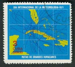
Cuba, 1971, 40mm x 36mm
The first of these two stamps show how the Atlantic tropical storm tracks seem irresistibly drawn to the island of Cuba, where, fueled by the warm Gulf waters, some of them turn into the “great” hurricanes making landfall. We see the lines of latitude and longitude, along with the neighboring land masses, South Florida, the Yucatán, Jamaica, Hispaniola, and the Bahamas, but no labels on them.

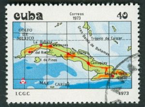
Cuba, 1973, 40mm x 28mm
Here’s an issue from two years later, minus the hurricane paths but plus a few labels and some indications of depth and elevation. The Florida mainland and most of the other islands are cropped away here, and it appears that a few latitude lines chosen are different from the ones from before. The main thoroughfare from Pinar del Rio in the west to Santiago del Cuba in the east is highlighted in red with knots indicating the main population concentrations. Not shown: the Bay of Pigs, Guantánamo.


