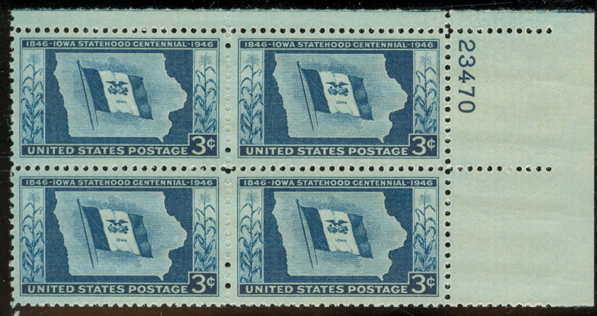
United States, 1946, Scott 942, 38mm x 23mm, plate block
The map on this stamp from six decades ago shows the outline of the US state of Iowa to commemorate the centenary of statehood. The monochrome blue design is adorned with a state flag and with the border showing a flowering stalk of corn to each side. No topographical features, towns or cities, or much of anything else is depicted. In particular, the great rivers, the Mississippi to the east and the Missouri to the west, are in evidence solely by the shape of the state borders there.
The state is at the center of the region that was hit hard by the floods in early summer of this year with several billion dollars of property damage. The recovery is expected to be fairly slow for the most affected areas, perhaps even slower now that the national and global economic situation has been thrown into turmoil. Were it not for this disaster, the news event of the year for Iowa might have been the way that during the first week of the year, the Iowa caucuses marked the first emergence of Barack Obama as a viable candidate for President.