A recurring theme of map stamp issues on Antarctic territorial claims is a graphical depiction by a wedge-shaped highlighted region, as if the continent were a pie being cut up into slices, the point being at the South Pole which all interested parties seem to want a piece of.

 Argentina, Scott 594, 1951, 22mm x 32mm
Argentina, Scott 562, 1947, 23mm x 33mm
Argentina’s territorial claims on Antarctica include the whole of the Antarctic Peninsula. In the later issue, there is a juxtaposition suggesting a sort of congruence between the angle subtended by Argentina itself (including the Falkland/Malvina and South Georgia Islands) and the choice of boundary meridians 74° and 25° W. The earlier issue has a legend (here almost obliterated by a heavy cancellation) reading SECTOR ANTARCTICO ARGENTINO, plus an inset of what looks like a ship of some type. The border emphasizes how the claim extends back to the early years of the 20th century.
 Argentina, Scott 446, 1935-51, 22mm x 33mm
Note how in this somewhat earlier issue, Argentina did not feel the need to emphasize their claim on the Antarctica at all.
 Chile, Scott 248, 1947, 22mm x 33mm
Chile’s claims on Antarctica stretching from 90° and 53° W longitude, as seen here, largely overlap those of Argentina and also include all of the Peninsula where that nation maintains a base. The legend here reads OCEANO GLACIAL ANTARCTICO, which I think has a nice ring to it. Also along the bottom, is the date (6 Nov 1940) and number (1747) of the declaration of this claim by the government.
 Falkland Islands Dependencies, Scott 1L3, 1946, 26mm x 32mm
Also overlapping these territorial claims to a considerable degree are those by Great Britain, as shown here in an issue by their disputed possession of the Falkland Islands Dependencies. This is the most detailed map of all, with all the major destinations in the South Atlantic picked out by name and the terrritorial claim (80° to 20° W longitude) shown in a rather modest way by two un-highlighted meridian lines. King George VI looks on from the upper right hand corner of the stamp.
Even after all the decades since these claims were first made, and the ones since these stamps were issued, the three conflicting claims by these nations have not been settled. Naturally, this would be a much stickier situation if the land in question were more populous.
 Australian Antarctic Territory, Scott L2, 1957-1959, 35mm x 23mm
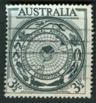
Finally, over on the other side of Antarctica, but still adopting the same pie-shaped strategy, we have the Australian claim between 44°38′ E and 160° E longitude. Interestingly, the territory is divide into two pieces by the French claim.
The South Pole is the only place on Earth where you can walk through all the time zones and through eight territorial claims in a matter of seconds.


