The secret revealed

3 08 2008

I asked “What do these stamps have in common?”

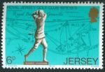
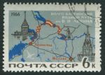
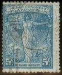
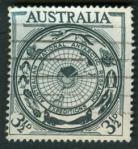
The answer is: each one of them lacks the conventional orientation of North at the top, South at the bottom, like over 90% of all map stamps. The first two have a tilted compass rose, the last two have the lines of latitude and longitude showing the orientation, and for the one in the middle, you either need to look at a map on your own or you have to be familiar with Bavaria.

Perhaps I was being a bit too devious. What do you think?


Time for a puzzle

9 07 2008

Yesterday I received my copies of the last two editions of the journal of the Cartophilatelic Society and was very happy to see the article I had written up. (It seems that my electronic address had gone astray somewhere along the way, so I had not been able to receive word the publication prior to this.) Here I present pictures of the five stamps which I used the illustrate the point of my piece. Incidentally, I notice that one of these stamps was also mentioned in a recent Marginalia column at the website.

Rather than just giving away the subject here, I thought I would try something different and set this up as a challenge for my readers. Can you see what the common theme is for all five of the issues depicted, which sets them apart from over 90% of all map stamps issued? It is something quite specific which any observant reader (or one who happens to have the April 2008 issue of the journal) would be able to state in very few words. When you have come up with the answer, put it into the comments on this post, and the first one with the correct interpretation will receive from me three map stamps from my accumulation.

Good luck!

West Germany, Scott 1009

Argentina, Scott 287

Australia, Scott 276

Jersey, Scott 183

Soviet Union, Scott 3180


The answer has been revealed


Links under the waves

28 05 2008

Malaya SEACOMMalaya SEACOM

Malaysia, Scott 42, 43, 1967, 70mm x 23mm
Back before there was broadband, even before there were satellite links to every part of the world, there were telephone and telegraph cables. This pair of stamps commemorates the completion of undersea links between Hong Kong and Malaysia as part of the the South East Asia Commonwealth network SEACOM. They are diptych designs, showing a detailed view of the route of the cable running from Singapore to eastern Australia, with a world map in projection on the right showing how that segment connects via New Zealand to North America and Europe. The jagged red line tracing the cable network illustrates well the vast distances required to ensure telecommunication around the globe. Only the colors of the inscriptions and of the background of the world map differs between the two. They were issued just a few years after Malaysia was constituted as an independent nation.

This portion of the international submarine cable network also linked Australia, New Guinea, Guam (not a Commonwealth realm), North Borneo, Singapore, and New Zealand. Since that time, of course, Hong Kong has ceased its status as a British Crown colony to become a special administrative region of China.


Understated cooperation

4 03 2008

brazil-1402Brazil, Scott 632, 1945, 37mm x 29mm
Here is another World War II commemorative masquerading as something celebrating international trade or something like that.

If one looks very closely at the destinations highlighted on this – Miami, Port [au] Prince, Puerto Rico, Trinidad, Georgetown, Belém, Fortaleza, Natal [Rio Grande do Norte], Ascencion, Accra, Khartoum, and Cairo – tiny little aircraft symbols oriented west to east can be seen. This represents the route of a major troop transport mission between the U. S. and the various war fronts:

[T]he huge Parnamirim field at Natal became the focal point in the Allied air transport system that ran west then north through Belém and the Guianas, across the Caribbean to Miami, and east over the Atlantic via Ascension Island and across Africa to the China-Burma-India theater.

Who knew? And who looking at this staid issue with its modest title and no especial emphasis on the battle front would have made the connection even back then?


More mutton, along with triumph, disaster, and woe

22 02 2008

New Zealand stamp.
New Zealand, Scott 237, 1940, 37mm x 22mm
This lovely green and purple item depicts the route of the square-rigger SS Dunedin which carried the first shipment of frozen mutton from Port Chalmers, New Zealand to England on the 15th of February, 1882. Sailing across the south Pacific, she negotiated the passage around Cape Horn and the long voyage up the Atlantic to London, a total of 12030 (nautical?) miles, with its cargo refrigerated the whole time. (No word on what the cargo was for the long return voyage.) The continents are labeled boldly on the map, which has a frame celebrating the centennial of New Zealand in the year of issue.

Although the stamp celebrates peaceful commerce, it was issued at a time when the threat to merchant shipping was most perilous, with wolf packs of German U-Boats patrolling the sea lanes of the Atlantic. I can only imagine that the sender of a letter bearing this stamp would have had thoughts of the war in mind seeing this little image. And perhaps if that person were nautically-minded, thoughts might also have turned to the loss of the Dunedin less than a decade after this historic voyage, presumed wrecked on the rocks of Cape Horn.

This, to me, is a fine example of the idea I had when I gave this blog the name it has. Long stretches of time and huge expanses of the Earth combined with the big events of history, all are carried by a little bit of ink on a rectangle of perforated paper.

A mercator projection and a temporal milestone

16 01 2008


Image Hosted by ImageShack.us
By milkfish, shot with HP Scanjet G3010 at 2008-02-02
Palau, Souvenir sheet, 2000

Oh, to return to the carefree days when all we had to worry about was whether our computers would lose their wits because of a programming shortcut and what we should bring to our gala party. “End of the millennium,” it was called, even though pundits all agreed that the new millennium was really going to begin a year later. I have a bunch of these souvenir sheets*, this one being issued by the South Pacific nation of Palau (known chiefly as the host of the tenth season of the reality series Survivor) and showing the march of time across the time zones. Or, something like the time zones, since the real time zone map does not follow the meridians anywhere near so strictly, owing to the man-made realities of national boundaries.

I remember exactly what I was doing the night the lefthand digit clicked over: I was home in bed with the flu. I had been planning to be helping staff the Tech Support lines at my old company in case there were any Y2K bugs we hadn’t caught, but a real live millennium bug took precedence for me, and it turned out that there were no software glitches at all that evening.

*Let me know in the comments if you want to see any of these, or, really, any other requests you might have.